
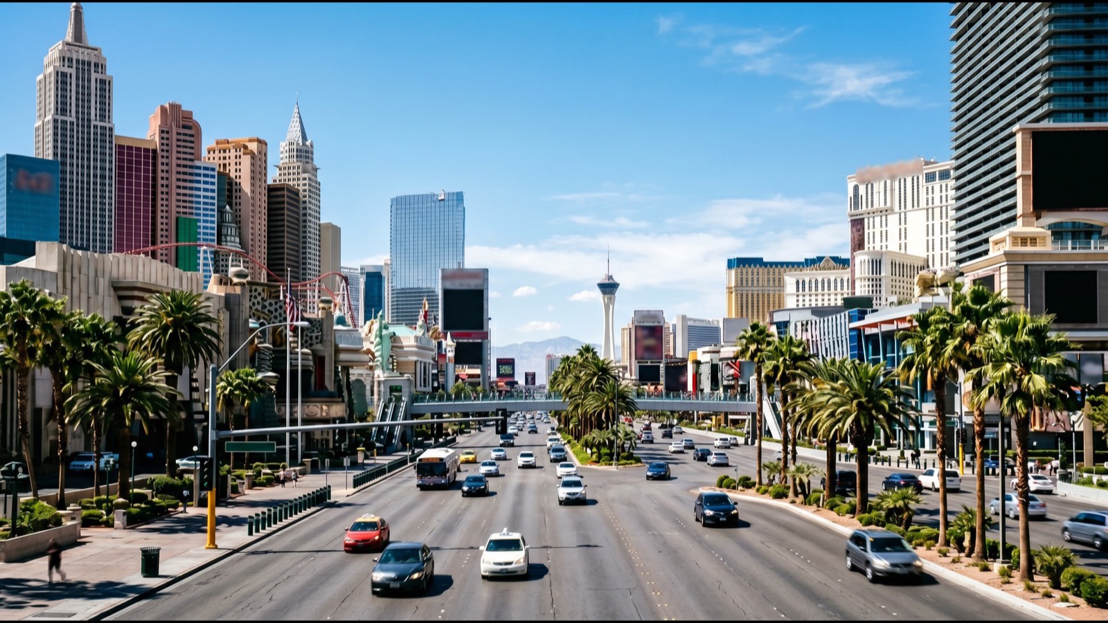
Welcome to Las Vegas. If you are thinking about living in Las Vegas rather than just visiting, the first thing to understand is that this city's scale is deceptive. Locals call it the "Strip Mirage." You stand at the Bellagio, look down the road at the MGM Grand, and assume it is a five-minute hop. In reality that is a mile-long walk in triple-digit heat. The same optical illusion plays out at the metro scale: the Las Vegas Valley looks compact on a map, but it stretches roughly 25 miles east to west and pushes commuters through a handful of freeway pinch points every morning.
For a homebuyer, that matters more than almost any other decision except price. Where you buy inside the valley sets your daily drive, your access to the Harry Reid International Airport and the Strip's 165,000-plus resort jobs, and — as we will show with live market data — a measurable slice of your home's value. This 2026 guide walks through the freeway skeleton, real drive times between master-plans and job centers, the Regional Transportation Commission (RTC) transit network, the future light-rail and tunnel projects, walkability by neighborhood, and how all of it feeds back into what buyers pay across Las Vegas, Henderson, Summerlin, and North Las Vegas.
Getting around Las Vegas in 2026 runs on three freeways — I-15, the 215 Beltway, and US-95 — plus the RTC bus network and the underground Vegas Loop. The metro's mean one-way commute is about 24 to 25 minutes, but where you buy swings it from 12 minutes (Enterprise to the airport) to 35-plus. Commute access is priced in: the median sale price sits near $440,678, yet central, transit-adjacent neighborhoods command a premium.
- Three freeways carry the valley: I-15, the 215 Beltway, and US-95.
- Enterprise and the southwest sit closest to Harry Reid Airport — often 12 to 15 minutes versus 30-plus from the far northwest.
- Las Vegas median sale price is $440,678; Summerlin runs $565,000, Henderson $499,990 (live GLVAR, mid-2026).
- RTC day passes cost about $8; the Deuce and CX buses cover the Strip, downtown, and airport car-free.
- Shorter commutes and transit access add resale value — factor drive time in before you fall for the house.
How Is the Las Vegas Valley Laid Out for Drivers in 2026?
The Las Vegas Valley is a bowl ringed by mountains, and nearly all of its traffic funnels onto three highways. Interstate 15 is the north-south spine, running straight past the Strip and connecting the valley to Los Angeles (south) and Salt Lake City (north). US-95 — which becomes I-11 heading toward Boulder City and Phoenix — carries the northwest suburbs down into downtown and out to the southeast. And the 215 Beltway (Bruce Woodbury Beltway) is the suburban ring road that loops the outer valley, linking Summerlin, the southwest, Henderson, and North Las Vegas without ever touching the tourist corridor.
According to the Nevada Department of Transportation (NDOT), the I-15 corridor through the resort district is one of the most heavily traveled stretches of highway in the state, which is exactly why locals avoid it at rush hour. The Beltway is the workaround: a homeowner in Summerlin can reach Henderson via the 215 in roughly 25 minutes without ever crossing the Strip's gridlock. Understanding this three-freeway skeleton is the single most useful thing a relocating buyer can learn, because it turns the "everything looks close" map into a realistic picture of daily life.
Across the 9,600-plus closings our team has represented across the valley, the most common regret we hear from out-of-state buyers is simple: they bought for the house and forgot the commute. A $30,000 price break on a home 18 miles from a spouse's job can evaporate into gas, time, and daily frustration within the first year. That is why we walk every relocating client through drive times before we walk them through floor plans.
What Are the Average Drive Times Between Master-Plans and Job Centers?
According to the U.S. Census Bureau's American Community Survey, the mean one-way commute in the Las Vegas–Henderson–Paradise metro is about 24 to 25 minutes — a hair below the national average and far shorter than Los Angeles or Phoenix. But that average hides enormous variation depending on which master-plan you choose. The table below shows typical off-peak drive times (real-world estimates that stretch 30 to 50 percent longer at 8 a.m. or 5 p.m.) from major residential areas to the four destinations buyers ask about most: the Strip, Harry Reid International Airport, the downtown medical district, and the closest major suburban job center.
| From | To the Strip | To Harry Reid Airport | To Downtown / Medical District |
|---|---|---|---|
| Enterprise / Southwest | 15 min | 12 min | 22 min |
| Summerlin | 20 min | 25 min | 22 min |
| Henderson (Green Valley) | 18 min | 18 min | 25 min |
| North Las Vegas (Aliante) | 25 min | 28 min | 20 min |
| Centennial Hills / NW | 28 min | 32 min | 25 min |
| Downtown / Arts District | 10 min | 15 min | 5 min |
The pattern is clear: Enterprise and the southwest are the airport-and-Strip sweet spot, while the far northwest around Centennial Hills trades a longer commute for newer homes and cooler evening breezes off the mountains. Per NDOT traffic-count data, the worst peak-hour bottlenecks sit on I-15 through the resort corridor and on the US-95/I-15 "Spaghetti Bowl" interchange downtown — so a buyer whose job is downtown but who wants a suburban house is usually better off in North Las Vegas (a straight US-95 shot) than in the southwest (which fights the Spaghetti Bowl).
How Does the 215 Beltway Change Where You Should Buy?
The 215 Beltway is the reason a Summerlin-to-Henderson commute is bearable. Before the Beltway loop was completed, cross-valley trips meant crawling through surface streets or the Strip. Today the 215 forms an outer ring that connects nearly every suburban master-plan, and NDOT's ongoing widening projects along the western and southern legs have added capacity that keeps those trips moving.
For buyers, the Beltway creates a simple rule of thumb: homes within about two miles of a 215 interchange enjoy dramatically better cross-valley access, and that convenience shows up in demand. Southwest neighborhoods that hug the Beltway — around Durango, Rainbow, and Warm Springs — pull steady interest precisely because a resident can reach the airport, the Strip, or Henderson's Green Valley employment nodes in under 25 minutes each. The trade-off is noise and traffic density near the on-ramps, which is why we steer noise-sensitive buyers a few blocks off the corridor while keeping the access.
According to the Regional Transportation Commission of Southern Nevada, regional planning continues to treat the Beltway as the backbone of future suburban mobility, including express bus service along parts of the loop. If your work is suburban rather than on the Strip, prioritize Beltway proximity over Strip proximity — it is the difference between a 20-minute life and a 40-minute one.
Which Las Vegas Neighborhoods Have the Shortest Strip and Airport Commutes?
The resort corridor and the airport together anchor the valley's largest concentration of jobs, so proximity to them drives both convenience and, often, price. Enterprise, the southwest, and Paradise sit closest to Harry Reid International Airport — frequently a 12 to 18 minute drive — which is why hospitality workers, pilots, and frequent business travelers cluster there. The table below pairs each area's live GLVAR median sale price with its typical airport commute so you can see the trade-off in one glance.
| Neighborhood (ZIP) | Median Sale Price | Typical Airport Drive |
|---|---|---|
| Enterprise (89178) | $487,450 | 12 min |
| Southwest (89148) | $487,500 | 15 min |
| Paradise (89169) | $385,000 | 10 min |
| Green Valley, Henderson (89052) | $682,500 | 18 min |
| Centennial Hills (89149) | $525,000 | 32 min |
| Aliante, North Las Vegas (89084) | $459,250 | 28 min |
Paradise — the unincorporated township wrapped around the airport and the east side of the Strip — offers the shortest airport hop and the lowest median at $385,000, though much of that inventory is condos and older homes rather than newer single-family product. Downtown Las Vegas posts a $360,000 median and a 10-to-15-minute Strip reach, making it the value pick for buyers who work in the resort corridor or the Symphony Park medical and government hub. If your priority is a short airport run in a newer home, the southwest and Enterprise are the clear winners; if it is maximum square footage per dollar, you accept a longer commute in Centennial Hills or North Las Vegas.
What Does RTC Public Transit Actually Cover in the Valley?
If you want to save your budget for a mortgage rather than a second car, the RTC bus system covers far more of the valley than most newcomers expect. The centerpiece on the tourist corridor is The Deuce, a double-decker bus that runs 24/7 from the south Strip up to the Fremont Street Experience downtown. A quick note for returning visitors: the old "SDX" Strip & Downtown Express was discontinued, so the Deuce now handles that workload.
For airport-to-downtown trips, the CX (Centennial Express) is a local secret — it uses the highway for most of the run, bypassing the bumper-to-bumper Las Vegas Boulevard traffic entirely. According to the RTC, fares are structured to be dramatically cheaper than a daily rideshare habit:
| Pass / Option | Price | Best For |
|---|---|---|
| 2-Hour Pass | $6 | A single round trip on the Strip or downtown |
| 24-Hour Pass | $8 | A full day of unlimited rides, all routes |
| 3-Day Pass | $20 | Conventions and short stays |
| Monthly Pass | $65 | Daily car-free commuting |
| Downtown Loop | Free | Arts District, Pawn Plaza, Bonneville Transit Center |
Download the rideRTC app to buy passes on your phone rather than fumbling for exact change. Beyond the tourist routes, RTC's residential coverage is strongest along the major arterials — Charleston, Sahara, Flamingo, Tropicana, and Boulder Highway — where 15-to-20-minute headways make car-free commuting realistic for jobs near those corridors. Coverage thins out in the newest master-plans on the valley's edge, which is the practical trade-off of buying brand-new on the fringe: more house, less transit. The RTC buses and the Downtown Loop are fully wheelchair accessible per ADA requirements.
Is Light Rail or the Vegas Loop Coming to the Suburbs?
This is where Las Vegas transit gets interesting. Three projects are reshaping how people will move around the valley over the next decade.
First, the Vegas Loop, built by The Boring Company, is a network of underground tunnels where you ride in a Tesla. As of 2026 it has expanded well beyond its original Convention Center circle to connect Resorts World, Westgate, Encore, and the Fontainebleau, with an airport connector operating in hybrid form and more resort stations under construction. Rides within the resort corridor typically run $2 to $5, and an airport drop from a spot like Resorts World lands around $12 — competitive with rideshare and immune to surface traffic.
Second, the RTC has advanced planning for a Maryland Parkway bus rapid transit (BRT) line — a higher-capacity, light-rail-style service connecting the airport, UNLV, the Sunrise medical corridor, and downtown along one of the valley's densest arterials. According to the RTC, Maryland Parkway is the corridor most likely to anchor the region's first true high-capacity transit spine.
Third, longer-range regional plans keep a valley-wide light-rail vision on the table, though funding and timelines remain uncertain. For a buyer today, the takeaway is practical: neighborhoods along Maryland Parkway and near confirmed Loop stations are the ones most likely to see transit-driven value gains, while the far suburbs will stay car-dependent for the foreseeable future. If you are betting on future transit lifting your resale value, the UNLV-to-downtown Maryland corridor is the safest bet on the board.
How Do Drive Times and Transit Access Affect Las Vegas Home Values?
This is the question that matters most for buyers and sellers, and it is the reason we merged our old drive-times explainer into this guide. The short answer, supported by decades of national housing research: commute time and transit access are capitalized into home prices. Homes with shorter commutes to major employment centers and better access to reliable transit consistently sell for more than otherwise-identical homes on the far fringe — the same three-bedroom floor plan is simply worth more when the daily drive is 15 minutes instead of 40.
You can see the effect in live GLVAR numbers. The valley-wide median sale price is $440,678, but Green Valley in Henderson — a mature, centrally located master-plan with quick Beltway and airport access — posts a $682,500 median, while newer but far-flung fringe ZIPs sit well below the central areas at comparable square footage. Part of that gap is home age and lot size, but a meaningful slice is pure location convenience. According to Las Vegas REALTORS, days on market also tighten in the well-connected central and Henderson submarkets (28 days) versus the far edge, and faster sales at higher prices are exactly what "commute is priced in" looks like in practice.
| Dimension | Central / Transit-Rich | Suburban / Beltway | Far Fringe |
|---|---|---|---|
| Example area | Paradise / Downtown | Southwest / Green Valley | Far NW / Far NLV |
| Median sale price | $360,000 to $385,000 | $487,500 to $682,500 | $459,250 to $525,000 |
| Airport commute | 10 to 15 min | 12 to 18 min | 28 to 32 min |
| Transit access | Strong (Deuce, CX, BRT-planned) | Moderate (arterial routes) | Weak (car-dependent) |
| Typical days on market | 25 to 32 | 28 to 31 | 22 to 32 |
| Home age | Older / condos | Mixed | Newest |
The strategic lesson cuts both ways. If you are buying, a longer commute can be a discount you exploit — accepting a 30-minute drive in the northwest to get a newer, larger home for the money. If you are selling, commute convenience is a feature to market loudly; buyers pay for it whether or not they consciously realize it. Our team's home value estimator folds location and comparable proximity into its read, and when we've listed a well-connected home we lead the marketing with drive times to the airport, the Strip, and the nearest hospital. If you are ready to price your own home, our seller team runs the same commute-aware comps.
How Walkable Are Las Vegas Neighborhoods for Homebuyers?
Las Vegas is, honestly, a car town — but walkability varies more than newcomers expect, and it is rising as a buyer priority. The most walkable pockets are Downtown Las Vegas and the Arts District, where the Fremont Street Experience is a car-free pedestrian mall and the 18b Arts District packs galleries, restaurants, and coffee shops into a genuinely strollable grid. The Downtown Loop free shuttle stitches these hubs together, so a downtown condo buyer can live largely car-light.
On the suburban side, the master-plans deliberately engineer walkability at the village scale rather than the city scale. Summerlin and Green Valley build trail networks, village centers, and parks within walking distance of homes — you can walk to a park, a school, or a coffee shop, even if you still drive to work. According to Clark County planning data, the newer master-plans dedicate substantial acreage to trails and open space precisely because buyers now rank walkable amenities near the top of their wish lists.
For a homebuyer, the practical filter is this: if you want true urban walkability (bars, restaurants, and work within walking distance), downtown and the Arts District are your only real options. If you want suburban walkability (parks, trails, and schools on foot, with a car for everything else), Summerlin, Henderson's Green Valley, and Cadence lead the valley. The heat is the constant caveat — summer highs top 100°F for weeks, so shaded trails and covered village centers matter more here than in a milder climate.
What Should Commuters Know About Parking, Tolls, and Daily Costs?
Two cost realities catch newcomers off guard. First, the Strip is no longer free to park. Major operators like MGM, Caesars, Wynn, and The Venetian now charge $18 to $25 per day for self-parking and $35 to $50 for valet, with a handful of holdouts — Treasure Island, Circus Circus, Sahara, and the Fashion Show Mall — still offering free spots. For a resident, this matters mainly if your job is on the Strip; many resort workers use employee lots or transit specifically to dodge the daily fee.
Second, Southern Nevada has no toll roads — the freeways and the Beltway are free, unlike the express lanes creeping into other Sunbelt metros. That keeps commuting costs predictable: your daily expense is fuel and time, not tolls. Locals who work near the Strip swap Las Vegas Boulevard for the parallel back roads — Frank Sinatra Drive on the west and Koval Lane on the east — to slip past the tourist gridlock into resort back entrances.
The heat adds a hidden cost too. Summer parking on unshaded surface lots turns a car into an oven, so covered parking and garage access carry real value in a home purchase here — a detail that rarely makes the listing sheet but shows up in resident satisfaction. In our experience, when we've toured homes with relocating buyers, garage orientation and shade land on the checklist right alongside commute time. Buyers weighing a brand-new build should also factor transit into the trade-off — see our new construction options.
How Do Henderson, Summerlin, and North Las Vegas Compare for Commuters?
Each of the big three suburban markets offers a distinct commute profile. Summerlin sits in the far west against Red Rock Canyon, giving fast Beltway access and a 20-minute Strip run but a longer 25-minute airport haul — and many of its guard-gated communities sit minutes from the 215. Henderson anchors the southeast with balanced access to the airport, the Strip, and its own large employment base around Green Valley and the St. Rose corridor. North Las Vegas rides US-95 straight downtown, making it the value play for downtown and medical-district workers. Our Getting Around Henderson and Getting Around Summerlin guides go deeper on each; the snapshot below compares them head to head on the metrics that decide a commuter's daily life.
| Market | Median List | Primary Freeway | Best For |
|---|---|---|---|
| Summerlin | $649,000 | 215 Beltway / Summerlin Pkwy | West-side and Strip commuters |
| Henderson | $540,134 | 215 Beltway / I-215 / I-11 | Balanced access, own job base |
| North Las Vegas | $425,000 | US-95 / I-15 | Downtown and value buyers |
| Southwest / Enterprise | $499,900 to $519,000 | 215 Beltway / I-15 | Airport and Strip proximity |
North Las Vegas leads on affordability at a $425,000 median list, and its US-95 alignment makes it genuinely underrated for anyone whose work is downtown or in the northern industrial and distribution corridor. Summerlin commands the premium at $649,000, reflecting both its amenities and its efficient west-side access. If you are still deciding between markets, our team can pull homes for sale filtered by your exact commute tolerance — a far better starting point than guessing from a map.
What Do Real Buyers Get Wrong About Las Vegas Commutes?
After thousands of valley transactions, we've seen the same three mistakes repeatedly. The first is trusting the map instead of the clock: two homes the same distance from downtown can have wildly different commutes depending on whether the route hits the Spaghetti Bowl. The second is buying at the far edge for the newest home, then discovering the daily 35-minute each-way drive erases the savings in fuel and lost time — over a 5-year hold, an extra 40 minutes a day is roughly 800 hours behind the wheel.
The third mistake is ignoring transit entirely because "nobody takes the bus in Vegas." That is changing. According to the RTC, ridership on the core Strip and arterial routes has recovered strongly, and the Maryland Parkway BRT and expanding Vegas Loop are actively adding car-light options. Buyers who position near those corridors are buying an option on future convenience — and often future value.
The fix for all three is the same: test-drive your commute at rush hour before you buy, not at noon on a Sunday. We build that into every relocation tour. If you want a second set of eyes on how a specific address commutes, reach out or call our team at (702) 637-1759 — we will pull the real drive times and the comparable sales in one sitting.
How Should You Factor Commute Into Your Home Search?
Start with your fixed points. Map where you (and a partner) actually have to be most weekdays — an office, a hospital, the airport, a school. Then work outward along the freeway skeleton: I-15 for Strip and north-south trips, US-95 for downtown and the northwest, and the 215 Beltway for everything suburban. Neighborhoods within two miles of a Beltway interchange give you the most flexibility as your life changes.
Next, set a commute budget the same way you set a price budget. If 25 minutes each way is your ceiling, that instantly narrows the valley to a workable set of master-plans and rules out the fringe bargains that would cost you hours. Then layer price on top using live comps — which is where our team earns its keep, matching your commute tolerance to real inventory in Las Vegas, Henderson, and North Las Vegas. For a broader relocation overview, our guide on living in Las Vegas covers cost of living, schools, and lifestyle, and if you are choosing an agent, start with who the best real estate agent in Las Vegas is.
Finally, weigh transit and walkability against future resale. A downtown condo or a Maryland Parkway address buys you car-light living now and a bet on transit-driven appreciation later; a far-northwest new build buys you space and quiet at the cost of a car-dependent daily grind. Neither is wrong — but knowing the trade-off before you sign is the difference between loving your home in year three and regretting the drive. When you are ready to translate all of this into a shortlist, our buyer team and live search tools turn commute math into a house.
Frequently Asked Questions
What is the average commute time in Las Vegas?
According to the U.S. Census Bureau's American Community Survey, the mean one-way commute in the Las Vegas–Henderson–Paradise metro is about 24 to 25 minutes — slightly below the national average. Your actual drive depends heavily on where you buy: Enterprise to the airport can be 12 minutes, while the far northwest to downtown can top 35 minutes at peak.
Do you need a car to live in Las Vegas?
For most residents, yes — the valley is car-oriented and the newest master-plans have limited transit. That said, downtown, the Arts District, and homes along major arterials like Maryland Parkway, Charleston, and the Strip are genuinely car-light thanks to the Deuce, CX, and Downtown Loop buses. If your job and daily life sit near those corridors, you can manage without a car.
Which Las Vegas neighborhoods have the shortest commute to the airport?
Enterprise, the southwest, and Paradise sit closest to Harry Reid International Airport, typically 10 to 15 minutes. Henderson's Green Valley is about 18 minutes, while Centennial Hills and northern North Las Vegas run 28 to 32 minutes. Hospitality workers and frequent travelers often prioritize the southwest and Paradise for exactly this reason.
Does a shorter commute increase a home's value in Las Vegas?
Yes. Commute time and transit access are capitalized into home prices — otherwise-identical homes closer to job centers and reliable transit consistently sell for more. On live GLVAR data, central and well-connected submarkets like Green Valley ($682,500 median) command a premium over comparable fringe homes, and they also sell faster at around 28 days on market.
What freeways run through Las Vegas?
Three: Interstate 15 (the north-south spine past the Strip), US-95 (which becomes I-11 toward Boulder City and carries the northwest to downtown), and the 215 Beltway (the suburban ring road connecting Summerlin, the southwest, Henderson, and North Las Vegas). There are no toll roads in Southern Nevada.
Is the Vegas Loop replacing public transit?
No. The Vegas Loop is a point-to-point Tesla tunnel system focused on the resort and Convention Center corridor, with rides typically $2 to $5. It complements rather than replaces RTC buses, which handle residential and citywide coverage. The RTC's planned Maryland Parkway bus rapid transit is the project most likely to become the valley's first true high-capacity transit spine.
How much does public transit cost in Las Vegas?
RTC fares are modest: a 2-hour pass is about $6, a 24-hour pass $8, a 3-day pass $20, and a monthly pass roughly $65. The Downtown Loop shuttle connecting the Arts District and Bonneville Transit Center is free. Buy passes through the rideRTC app rather than paying cash on board.
Which Sources Inform This Las Vegas Commuting Guide?
The data in this guide draws on live GLVAR MLS statistics (trailing 90 days, pulled mid-2026 for each ZIP and city) alongside public transportation and demographic authorities. Median prices, days on market, and inventory counts come from the Repliers-backed Las Vegas REALTORS feed; commute and freeway context from NDOT and RTC planning data; and metro commute averages from the U.S. Census Bureau. Always verify current figures with your agent before making an offer, since market conditions shift month to month.
- Las Vegas REALTORS (LVR / GLVAR) — monthly market statistics and MLS data
- Regional Transportation Commission of Southern Nevada (RTC) — transit routes, fares, and BRT planning
- Nevada Department of Transportation (NDOT) — freeway traffic counts and construction
- U.S. Census Bureau — American Community Survey — metro commute times
- Harry Reid International Airport — airport access and ground transportation
- Clark County, Nevada — planning, parks, and open-space data
- U.S. Bureau of Labor Statistics — Las Vegas metro employment
- Federal Highway Administration (FHWA) — commuting and highway research
- The Boring Company — Vegas Loop — tunnel network and stations
- U.S. Department of Transportation — national transit and mobility research
- Clark County School District (CCSD) — school locations for family commute planning