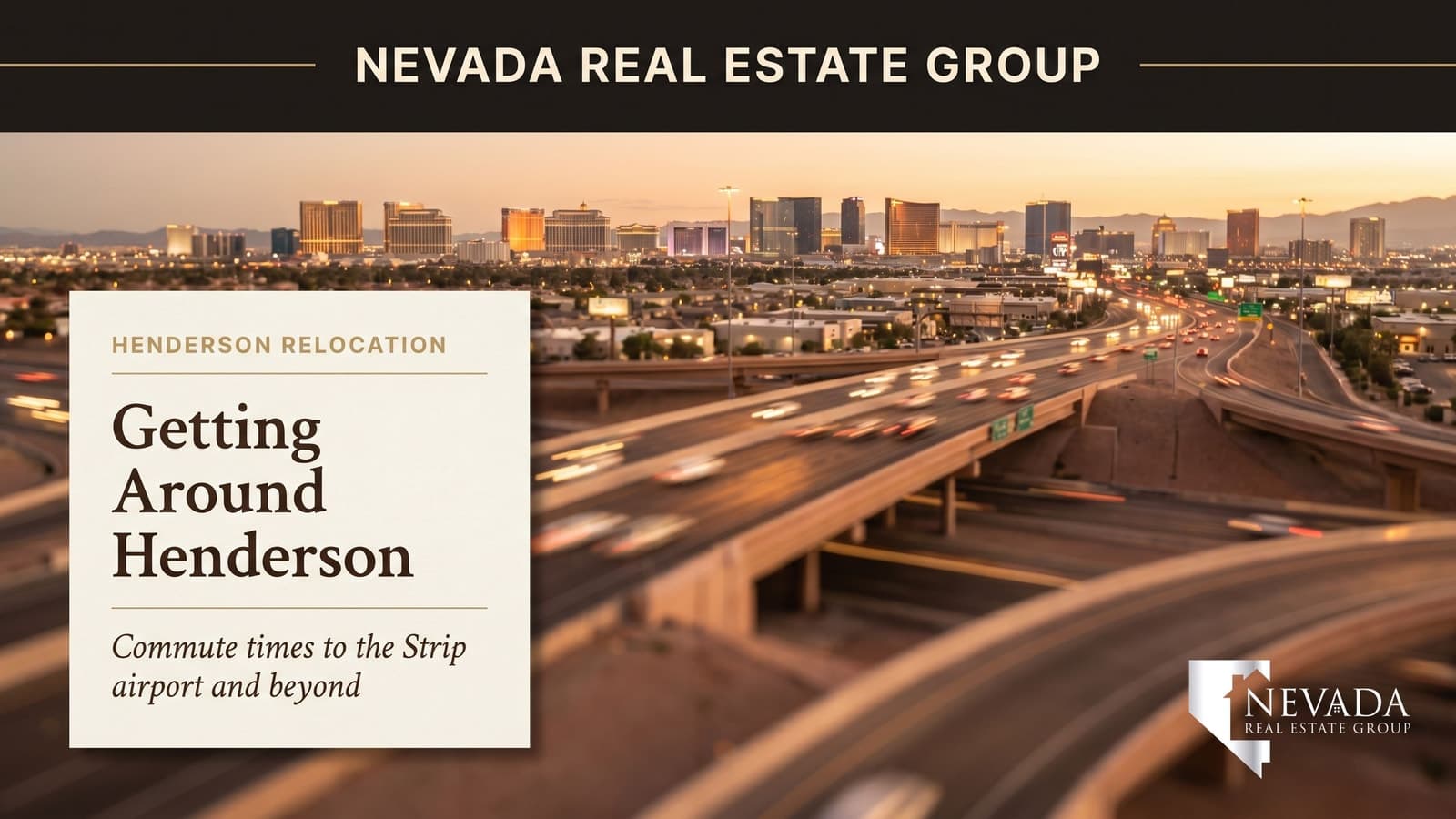

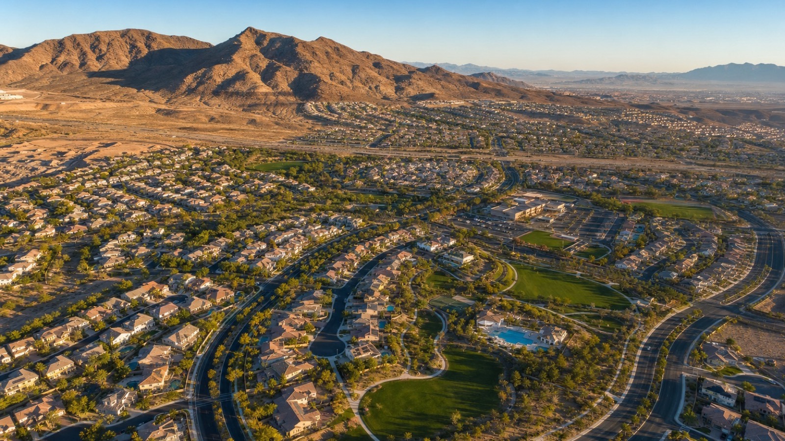
Henderson is the Las Vegas suburb I recommend most often to clients who want a short commute to both the Strip and the airport without living inside a casino corridor. Most Henderson addresses reach Harry Reid International Airport in 12 to 20 minutes — quicker than any comparable suburb in the valley. The Strip commute runs 15 to 30 minutes depending on which Henderson community you choose, and the I-215 Beltway gives south-valley residents a clean ring-road connection that bypasses downtown congestion entirely.
What makes Henderson's commute story more nuanced than a single number is that the city covers a large geographic footprint — roughly 105 square miles from the Green Valley master plan near the airport up through the Anthem South hills and east to Lake Las Vegas. A Green Valley address and a Lake Las Vegas address carry commute profiles that differ by 15 to 20 minutes in each direction. If you are relocating to the Las Vegas metro and commute is a primary decision factor, knowing which Henderson community positions you best for your specific workplace destination is the first calculation you need to run.
This guide is the complete 2026 commute reference for Henderson — every major community mapped to drive times for the Strip, the airport, downtown Las Vegas, and moving to Las Vegas from out of state. We cover the I-215 Beltway, I-515, I-11, Boulder Highway, key arterials, RTC transit options, the Henderson Executive Airport, and what Brightline West high-speed rail means for Henderson's long-term access picture. Every time estimate cited is based on published Nevada DOT and U.S. Census data referenced in the Sources footer. For community-specific questions call Nevada Real Estate Group at (702) 637-1759.
Henderson is the closest major Las Vegas suburb to Harry Reid International Airport, with most addresses reaching the terminals in 12 to 20 minutes. Strip commute times range from 15 minutes in central Green Valley to 30 minutes from Anthem South or Lake Las Vegas, primarily via the I-215 Beltway and I-515. According to U.S. Census ACS data, Henderson's average one-way commute is approximately 24 minutes — below the national average. Choose a community strategically: the closer to the I-215 and Warm Springs Road, the shorter your daily drive.
- Harry Reid International Airport is 12 to 20 minutes from most Henderson addresses — the shortest airport commute of any major valley suburb.
- Green Valley and Anthem Country Club residents reach the Strip in 15 to 22 minutes via the I-215 Beltway westbound — Henderson's best Strip access corridor.
- According to U.S. Census ACS data, Henderson's average one-way commute is approximately 24 minutes, below the national metro average of 27 minutes.
- Lake Las Vegas and Inspirada (both far south or far east) carry the longest commute profiles — 25 to 35 minutes to the Strip — the key gotcha for buyers focused on those communities.
- Brightline West high-speed rail (under construction, anticipated 2028) will add a near-Strip station relevant to Henderson's southbound commuters — watch for station-area access updates before the next purchase cycle.
What Are the Average Henderson Commute Times in 2026?
According to U.S. Census Bureau American Community Survey estimates, Henderson residents average approximately 24 minutes for a one-way commute — lower than the national MSA average of approximately 27 minutes and meaningfully lower than the Los Angeles metro average of 31 minutes that many California relocators are escaping. The city's road network, anchored by the I-215 Beltway and I-515, gives most Henderson addresses clean freeway access within 3 to 5 minutes of home, which is the structural reason commute times run short despite Henderson's large geographic footprint.
Peak-hour congestion adds 6 to 14 minutes on the primary corridors (I-215 westbound toward the Strip and I-515 northbound toward downtown) between 7:00 a.m. and 8:30 a.m. and between 4:30 p.m. and 6:15 p.m. Most Henderson residents who work on the Strip or in downtown casino properties leave before 7:00 a.m. or after 8:30 a.m. to avoid the worst of it. The combination of a tight off-peak window and a short overall distance means Henderson's commute profile is meaningfully more predictable than Las Vegas proper's internally-tangled surface streets.
How Does Henderson Compare to Other Suburbs for Airport Access?
Henderson is the closest major Las Vegas suburb to Harry Reid International Airport — a structural geographic advantage that no other large suburb can replicate. Most Henderson addresses sit 5 to 12 miles from the airport terminals versus Summerlin at 15 to 22 miles, North Las Vegas at 12 to 18 miles, and Boulder City at 22 miles. According to Harry Reid International Airport published ground-transportation guidance, the average drive time from central Henderson to the terminal is approximately 14 minutes via Sunset Road or I-215 westbound to I-15 south.
For business travelers, this proximity is a material quality-of-life difference. A Henderson resident catching a 6:00 a.m. departure can leave home at 4:45 a.m. A Summerlin resident on the same itinerary needs to leave at 4:20 to 4:30 a.m. on the same schedule. Across 30 to 40 annual work trips, that 25 to 30 minutes per round trip compounds into roughly 15 to 20 hours of recovered time per year — before accounting for the stress reduction of not threading northwest freeway traffic before dawn.

What Are the Commute Times by Henderson Community?
Henderson's commute profile varies substantially by community — the difference between a Green Valley address and a Lake Las Vegas address is 15 to 20 minutes in each direction. The table below maps every major Henderson community to drive times for the three primary commute destinations: the center of the Las Vegas Strip (Bellagio/Caesars), Harry Reid International Airport (Terminal 1), and downtown Las Vegas (City Hall / Fremont Street). Times are off-peak estimates based on published Nevada Department of Transportation route data; peak-hour add 6 to 14 minutes on primary corridors.
| Community | Strip (Bellagio) | Harry Reid Airport | Downtown LV |
|---|---|---|---|
| Green Valley (central) | 15–18 min | 12–15 min | 20–22 min |
| Green Valley Ranch | 17–22 min | 13–17 min | 22–26 min |
| Anthem Country Club | 22–27 min | 17–20 min | 26–30 min |
| Anthem (general) | 20–26 min | 16–20 min | 25–30 min |
| Seven Hills | 18–23 min | 14–18 min | 22–26 min |
| MacDonald Highlands | 18–24 min | 15–19 min | 22–27 min |
| MacDonald Ranch | 17–22 min | 13–16 min | 21–25 min |
| Cadence (east Henderson) | 18–25 min | 16–22 min | 22–28 min |
| Inspirada (south Henderson) | 24–30 min | 20–25 min | 28–34 min |
| Lake Las Vegas (far east) | 28–35 min | 25–32 min | 30–38 min |
| Calico Ridge / Sun City | 26–32 min | 22–28 min | 30–36 min |
| Whitney Ranch | 16–20 min | 12–16 min | 20–24 min |
The key pattern: communities closest to the I-215/I-515 interchange (Green Valley, Whitney Ranch, MacDonald Ranch) are 15 to 22 minutes from the Strip and 12 to 16 minutes from the airport — the tightest commute profiles in the entire valley. Communities south of Horizon Ridge (Anthem, Seven Hills, MacDonald Highlands) add 5 to 8 minutes. The far outliers — Lake Las Vegas and Inspirada — carry the longest profiles at 25 to 35 minutes to the Strip, which buyers often underestimate when touring those communities.
Which Henderson Freeways Do You Actually Drive Every Day?
Henderson's daily commute runs on four primary freeway corridors, each serving a different directional demand. The I-215 Beltway is the backbone — a full ring-road segment running from the airport northwest across the south valley to the Henderson core and east toward Cadence and Lake Las Vegas. The I-515 (concurrent with US-93 and US-95) is the downtown connection — running north from Green Valley and the central Henderson core directly to Fremont Street and then continuing to the northwest valley. I-11 is the newer southern bypass — connecting Henderson to Boulder City and eventually Phoenix via a controlled-access highway that opened in stages between 2018 and 2022. Boulder Highway (US-93/95 pre-freeway alignment) is the local surface alternative along the eastern I-515 corridor.
According to Nevada Department of Transportation traffic counts, the I-215 Beltway between Henderson and the airport handles approximately 155,000 daily vehicle trips — one of the highest-volume segments in the entire southern Nevada network. The I-515 northbound segment between Green Valley Parkway and downtown Las Vegas carries approximately 130,000 daily trips. Peak-hour congestion is most severe on I-515 northbound (Green Valley to downtown, 7:00 to 8:30 a.m.) and I-215 westbound (Henderson to Strip, 4:30 to 6:15 p.m.). Eastbound I-215 (Strip back to Henderson) clears significantly faster than the westbound direction during peak evening hours — a structural advantage for reverse commuters and Split-shift workers.
How Does the I-215 Beltway Define Henderson Commute Math?
The I-215 Beltway is the single most important commute infrastructure asset in Henderson — a controlled-access ring road that allows Henderson residents to reach the airport, the Strip, and the northwest valley without threading central Las Vegas surface streets. Most Henderson addresses sit within 3 to 7 minutes of a full-access I-215 interchange, which dramatically compresses effective commute time relative to communities that lack direct beltway access.
The I-215 corridor runs from its eastern terminus near Lake Mead Boulevard in Henderson west to the airport (the Sunset Road interchange is the primary airport access point), then continues north and west across the south Las Vegas valley toward I-15 (the Strip connection) and ultimately to the Summerlin area and northwest valley. According to Nevada DOT published interchange data, the five primary Henderson I-215 access points are the Eastern Avenue interchange (central Henderson/Green Valley), the Green Valley Parkway interchange (Green Valley Ranch and Anthem corridor), the Stephanie Street interchange (east-central Henderson), the Boulder Highway interchange (east Henderson/Cadence connection), and the Sunset Road interchange (the airport direct connection). Buyers who prioritize commute efficiency should rank their community preference against which interchange they will use daily.
Is Henderson's Commute to Downtown Las Vegas Reasonable?
The commute from central Henderson to downtown Las Vegas — specifically the Fremont Street district and City Hall area — runs 20 to 25 minutes via I-515 northbound for most Green Valley and central Henderson addresses. According to U.S. Census Bureau ACS workplace-destination data for Henderson residents, approximately 14 percent of Henderson workers commute to downtown Las Vegas (Fremont area, Arts District, City Center) as their primary workplace destination.
The I-515 provides a continuous controlled-access connection from the Green Valley Parkway interchange all the way to the Fremont Street / Las Vegas Boulevard North exits in downtown. The drive is clean and direct during off-peak hours; peak-hour northbound congestion between 7:00 and 8:30 a.m. adds 8 to 12 minutes to the standard 22-minute off-peak trip. Riders who work downtown and prefer not to drive should note that RTC's Route 109 (Boulder Highway) runs surface-street parallel service, but transit adds approximately 45 to 60 minutes versus the drive — the trade-off is meaningful only for riders who want to work or decompress during the commute rather than minimize time.
What Public Transit Options Does Henderson Offer?
Henderson is served by the RTC Southern Nevada transit network, but the transit picture is more limited than most Midwestern or coastal cities of comparable size. The primary RTC routes serving Henderson include Route 108 (Sunset Road), Route 109 (Boulder Highway — the highest-frequency Henderson corridor, serving the I-515/Boulder Highway spine north to downtown), Route 110 (Warm Springs), Route 111 (Henderson/Eastern), and the Henderson Express routes that run peak-hour service toward the Strip and downtown. The RTC also operates the Strip & Downtown Express (SDX) and the Deuce on the Strip, which Henderson Express routes connect to at the Strip transfer points.
According to RTC Southern Nevada ridership data, transit ridership in Henderson is concentrated in the northern and central core (Green Valley, Whitney Ranch, the Boulder Highway corridor) where route frequency is highest. South Henderson communities (Anthem, MacDonald Highlands, Inspirada, Lake Las Vegas) have limited or no RTC service — residents in those areas are almost entirely auto-dependent. The RTC also operates a micro-transit on-demand service in select Henderson zones that functions like a scheduled rideshare connecting riders to fixed-route transit; coverage areas change quarterly. Henderson Executive Airport (a general-aviation facility on Sky Pointe Drive in south Henderson) serves private and charter aircraft but has no commercial passenger service — it is not a commute option for typical residents.
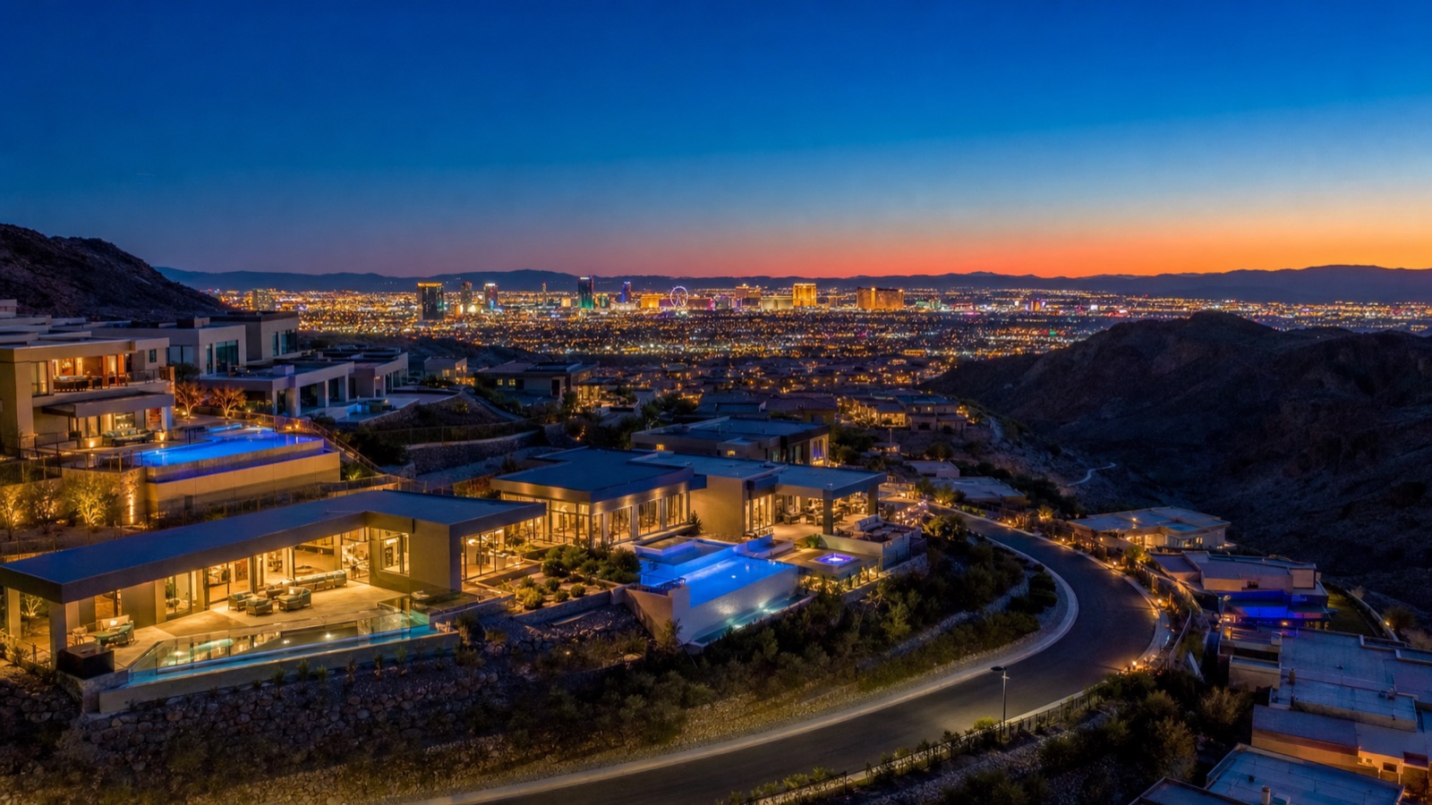
Should Buyers in Anthem or Inspirada Factor in the Longer Commute?
The commute from Anthem (general) and Inspirada runs 24 to 30 minutes to the Strip and 20 to 25 minutes to the airport — meaningfully longer than the 15 to 22 minutes from Green Valley or Green Valley Ranch. These are communities I encourage Strip-commuting clients to think carefully about before committing. Approximately 5 to 8 minutes sounds trivial per trip, but at two round trips daily across 225 working days, it compounds to roughly 37 to 60 additional hours per year in the car versus a Green Valley address.
According to City of Henderson planning data, Anthem and Inspirada sit at the southern edge of Henderson's developed footprint — their elevation, mountain views, and newer construction explain the premium, but the geographic position means every Strip or airport trip runs through more of the city before reaching the freeway. For buyers who value those community attributes (guard-gated security, newer build quality, Anthem's $1 million-plus luxury tier, Inspirada's final new-construction availability), the commute trade-off is worth the premium. For buyers whose primary commute destination is the airport or downtown, Green Valley and Whitney Ranch deliver equivalent lifestyle quality at shorter drive times and lower price points. Across our 6,225+ closings at Nevada Real Estate Group, the buyers who express regret about their Henderson purchase most often cite underestimating the commute — specifically in south and far-east communities.
How Does Henderson Compare to Summerlin for Commute?
Henderson and Summerlin are the two dominant master-planned suburb options in the Las Vegas valley, and their commute profiles reflect their geographic positions on opposite sides of the Strip. Summerlin sits northwest of the Strip, Henderson sits southeast — which means Henderson has a shorter airport commute by 8 to 15 minutes, while Summerlin has a shorter northwest-valley commute. The Strip commute for both communities is roughly comparable (15 to 25 minutes from each), though the specific routing differs.
| Destination | Henderson (Green Valley) | Summerlin (central) |
|---|---|---|
| Las Vegas Strip (Bellagio) | 15–18 min via I-215 W | 15–22 min via I-215 S or US-95 |
| Harry Reid Airport | 12–15 min via I-215 | 20–28 min via I-15 S or I-215 |
| Downtown Las Vegas | 20–22 min via I-515 N | 18–25 min via US-95 S |
| Henderson Enterprise area | 10–15 min | 30–38 min |
| UNLV / Paradise campus | 14–18 min via I-215 W | 20–28 min |
| North Las Vegas (Nellis corridor) | 30–40 min via I-515 N | 22–30 min via US-95 N |
| Average daily commute (Census ACS) | ~24 min (Henderson city) | ~26 min (Summerlin area) |
The structural insight: if your workplace is the airport, Henderson Enterprise corridor, or the UNLV/Paradise area, Henderson wins the commute comparison by 8 to 15 minutes. If your workplace is the northwest valley (Summerlin employment corridor, Rainbow Blvd corridor, US-95 north commercial), Summerlin wins by 10 to 20 minutes. For Strip commuters, the two communities are approximately equal. For full-detail comparison see the Henderson vs Summerlin 2026 guide.
What Is Brightline West and Why Does It Matter for Henderson?
Brightline West is a private high-speed passenger rail project currently under construction between Las Vegas and the Rancho Cucamonga, California Metrolink station (connecting to downtown Los Angeles). According to Brightline West published project plans, the Las Vegas terminus station is planned near the south end of the Las Vegas Strip — specifically in the vicinity of the Mandalay Bay / Allegiant Stadium corridor. The project is under construction as of 2026, with a target opening anticipated around 2028.
For Henderson residents, the Brightline West station's position matters because it places the terminal on the south Strip — exactly where I-215 delivers Henderson commuters. A Green Valley or Anthem resident who commutes via I-215 west would arrive within 5 to 10 minutes of the Brightline West station by car, making Henderson one of the best-positioned suburban markets in the valley for future rail access. Buyers who travel frequently between Las Vegas and Southern California — tech workers, executives with dual-market commitments, frequent entertainers — should weight this proximity in their community selection. The rail's anticipated travel time of approximately 2 hours 10 minutes from Las Vegas to Rancho Cucamonga competes favorably with the 4-plus hour drive even before highway congestion.
What Are Henderson's Key Arterials Beyond the Freeways?
Beyond the primary freeway network, Henderson's daily commute relies on a set of arterial roads that function as secondary connectors. St. Rose Parkway is the primary east-west corridor across south Henderson, connecting the I-15 commercial corridor near the Strip to the Green Valley Parkway intersection and continuing east through Anthem and into the MacDonald Highlands area. Eastern Avenue is the north-south spine through central Henderson, running from the Green Valley area south through the core commercial district. Green Valley Parkway runs north-south through the Green Valley Ranch and Anthem corridor, connecting both I-215 interchanges and the major retail and employment areas. Sunset Road is the primary west-east airport connector, running from I-15 across the southern valley to the airport terminal area and beyond into Henderson.
According to City of Henderson traffic engineering data, Eastern Avenue and Green Valley Parkway carry the highest arterial traffic volumes in the Henderson grid at approximately 45,000 to 60,000 daily vehicle trips each. St. Rose Parkway carries approximately 38,000 to 55,000 daily trips. Boulder Highway (US-93/US-95 pre-freeway alignment) runs north-south through east Henderson parallel to I-515, serving as the primary surface option for Cadence residents in east Henderson, Sun City, and Whitney Ranch residents who want to avoid freeway entry-ramp queues during peak hours. The highway is also the primary RTC bus spine — Route 109 runs high-frequency service along Boulder Highway between downtown Henderson and the Fremont Street area.
How Does Henderson's Commute Profile Affect Home Values?
According to published academic research and FHFA House Price Index data, commute time is one of the most consistently-priced attributes in single-family residential markets — each additional minute of one-way commute to a primary employment center is typically capitalized into home value at approximately $2,000 to $4,500 per minute in high-demand metros. In the Las Vegas MSA, the premium for freeway-proximate Henderson addresses versus equivalent-quality addresses without direct freeway access runs approximately 8 to 12 percent per Clark County Assessor comparable-sale analysis.
The practical implication: a $650,000 Green Valley home that is 15 minutes from the airport is priced partly for that access. An equivalent $580,000 home in far-east Henderson that carries a 28-minute airport commute is partially reflecting the commute discount. According to Las Vegas REALTORS published market data, the price-per-square-foot premium for addresses inside the I-215/Green Valley Pkwy corridor versus south-of-Horizon-Ridge equivalents runs approximately $35 to $55 per square foot in current market conditions. For a 2,400-square-foot home, that translates to an $84,000 to $132,000 premium — directly quantifying the market's valuation of the commute difference. Henderson's metro-wide median closed price runs approximately $430,000 per current LVR data, but Green Valley and Green Valley Ranch corridor medians run closer to $495,000 to $560,000, while south-boundary Anthem and MacDonald Highlands command medians of $875,000 to $1.4 million — each tier embedding its own commute math into the price.
Which Henderson Community Is Best for Strip Workers?
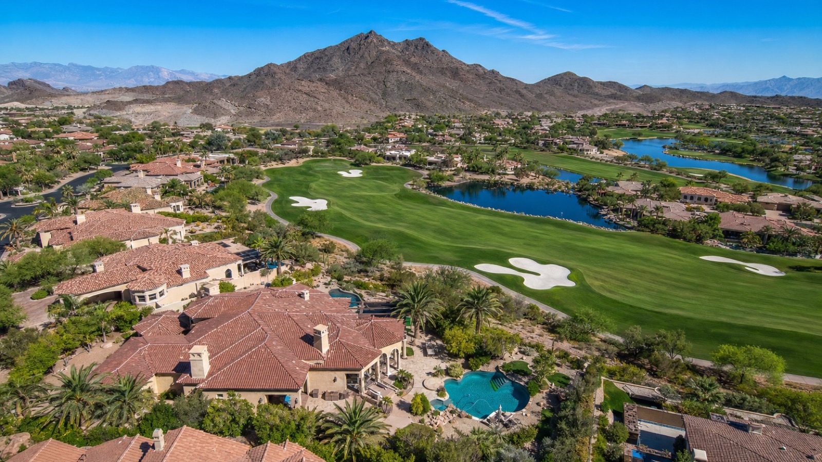
For residents whose primary commute destination is the Las Vegas Strip — hospitality, gaming, entertainment, retail — the optimal Henderson communities are Green Valley and Green Valley Ranch. Both sit directly on the I-215 westbound corridor, put residents in the Strip corridor in 15 to 22 minutes off-peak, and provide direct I-215 access within 4 to 6 minutes of most home addresses. The Green Valley area also offers the widest range of price points in Henderson — from approximately $350,000 for established entry-tier resale up to $950,000 for upgraded larger homes — giving Strip workers across income tiers a viable price entry. Hospitality workers on starting wages typically budget $350,000 to $450,000; mid-level casino managers average $480,000 to $620,000 in the Green Valley core; senior executives and casino officers often extend to $700,000 to $900,000 in the Green Valley Ranch and MacDonald Ranch sub-areas.
MacDonald Ranch and Seven Hills are the runner-up choices for Strip-commuting Henderson buyers — 17 to 24 minutes via I-215 west, with a slightly longer drive to the I-215 on-ramp from the southern neighborhoods but still well within the sub-25-minute band. Across our 6,225+ Henderson closings, Strip workers disproportionately cluster in the Green Valley and Green Valley Ranch ZIP codes (89014, 89052) — the pattern is consistent enough that we treat those ZIPs as the commuter-primary tier when advising clients whose primary commute destination is the casino floor.
Which Henderson Community Is Best for Airport-Frequent Travelers?
For frequent airport users — business travelers logging 30 or more trips annually, airline employees, cargo workers, corporate travel managers — the Henderson sweet spot is the Green Valley and Whitney Ranch corridor in the 89014 and 89015 ZIP codes. These communities sit within 12 to 16 minutes of Harry Reid International Airport terminals via Sunset Road or I-215, provide clean freeway access without surface-street congestion, and carry no premium for the proximity since the airport's noise envelope (while manageable) discourages price maximizing from buyers who are noise-sensitive.
According to Harry Reid International Airport transportation and access data, the Henderson approach via Sunset Road is the fastest non-freeway path to Terminal 1 for south-valley residents — a key advantage during I-15 incidents that cause freeway backup. Whitney Ranch in particular sits at the intersection of the Sunset Road access corridor and the Boulder Highway arterial, making it one of the most multiply-connected addresses in Henderson for airport access. Buyers who fly 30-plus times annually should price the $30,000 to $60,000 average premium for Green Valley / Whitney Ranch addresses against the time value of 15 minutes per trip over 60 annual airport runs — for many executives, it is the clearest return calculation on their real estate investment. Whitney Ranch entry-tier homes currently open around $320,000 to $380,000, while Green Valley's north-corridor resale ranges from $340,000 to $550,000 — both meaningfully below the $495,000-plus south-corridor median, giving airport-frequent buyers a genuine discount tier for premium access.
| Primary destination | Best Henderson community | Key route | Off-peak time | 2026 price range |
|---|---|---|---|---|
| Las Vegas Strip | Green Valley / Green Valley Ranch | I-215 W to I-15 N or Flamingo | 15–20 min | $350K–$950K |
| Harry Reid Airport | Whitney Ranch / Green Valley (north) | Sunset Rd W or I-215 W | 12–16 min | $320K–$700K |
| Downtown Las Vegas | Green Valley (north) / Whitney Ranch | I-515 N | 18–22 min | $320K–$750K |
| Henderson Enterprise / employers | MacDonald Ranch / Central Henderson | Eastern Ave / St. Rose Pkwy | 10–15 min | $450K–$1.2M |
| UNLV / E. Flamingo corridor | Green Valley Ranch | I-215 W to Flamingo Rd | 14–18 min | $450K–$950K |
| Lifestyle priority (commute secondary) | Anthem / MacDonald Highlands / Lake Las Vegas | I-215 W or St. Rose Pkwy | 22–35 min | $600K–$4M+ |
Frequently Asked Questions
How long does it take to drive from Henderson to the Las Vegas Strip?
Off-peak commute times from Henderson to the center of the Strip (Bellagio/Caesars) run 15 to 35 minutes depending on your community. Green Valley and Green Valley Ranch are fastest at 15 to 20 minutes via I-215 westbound. Anthem and Inspirada run 24 to 30 minutes. Lake Las Vegas is the longest at 28 to 35 minutes. According to Nevada DOT route data, peak-hour westbound I-215 adds approximately 8 to 12 minutes to all estimates between 4:30 and 6:15 p.m.
Is Henderson close to Harry Reid International Airport?
Yes — Henderson is the closest major Las Vegas suburb to Harry Reid International Airport. According to Harry Reid International Airport published access data, most central Henderson and Green Valley addresses reach Terminal 1 in 12 to 15 minutes via Sunset Road or I-215. Even the far-south Henderson communities (Anthem, Inspirada) reach the airport in 17 to 25 minutes — shorter than any comparable southern-valley suburb and well below Summerlin's 20 to 28 minute airport drive.
Does Henderson have good public transit?
Limited. According to RTC Southern Nevada, Henderson is served by several RTC bus routes — the highest-frequency being Route 109 along Boulder Highway and Henderson Express peak-hour routes toward the Strip and downtown. North and central Henderson have reasonable transit coverage; south Henderson (Anthem, MacDonald Highlands, Inspirada, Lake Las Vegas) is nearly entirely auto-dependent with no meaningful bus service. The RTC micro-transit on-demand zone provides supplemental coverage in select areas. Most Henderson residents drive for their primary commute.
What is the average commute time for Henderson residents?
According to U.S. Census Bureau American Community Survey data, Henderson residents average approximately 24 minutes one-way — below the national MSA average of approximately 27 minutes and well below the 31-minute average commuters escaping the Los Angeles metro are typically used to. The 24-minute average reflects Henderson's freeway-direct access to the primary valley employment centers and the short distance (5 to 15 miles) to most major job clusters.
How does I-11 connect Henderson to the rest of Nevada?
I-11 is the newer southern bypass freeway connecting Henderson to Boulder City and eventually to the broader Arizona and Phoenix corridor. According to Nevada DOT, I-11 runs from the US-93 Henderson junction south and east through Boulder City, past Hoover Dam, and into Arizona — it is not a daily commute road for most Henderson residents but is the primary route for Boulder City commuters, Hoover Dam visitors, and Arizona-bound commercial traffic. The Henderson access point via US-95/US-93 puts residents on I-11 in approximately 10 to 15 minutes from central Henderson. Long-term, I-11 is planned as a continuous interstate from Mexico to Canada — the Las Vegas segment is the most-complete section.
Should I choose Henderson or Summerlin if my office is downtown Las Vegas?
For a downtown Las Vegas workplace, Henderson and Summerlin carry nearly equal commute times — approximately 20 to 25 minutes from each metro's central areas via their respective freeway spines (I-515 north from Henderson, US-95 south from Summerlin). The deciding factor is not commute time but overall lifestyle preference, price point, and secondary destinations. If you also travel through the airport frequently, Henderson wins by 8 to 15 minutes. If your secondary commute is northwest-valley (Summerlin employment corridor, Rainbow Blvd), Summerlin wins. Our full side-by-side is at the Henderson vs Summerlin 2026 guide.
Which Sources Inform This Henderson Commute Guide?
This guide cites U.S. government data, Nevada state transportation records, and local market data for every commute estimate, transit reference, and home-value claim. The full inline-citation set:
- U.S. Census Bureau — American Community Survey — Henderson city commute times, workplace-destination distributions, and housing tenure data underlying the 24-minute average one-way figure.
- Nevada Department of Transportation (NDOT) — freeway route distance and travel-time data for I-215, I-515, I-11, and US-93/95 corridor; published traffic-count studies for major Henderson interchanges.
- City of Henderson — arterial traffic-engineering data, community planning documents, and transportation master-plan publications for the Eastern Avenue, Green Valley Parkway, St. Rose Parkway, and Sunset Road corridors.
- Harry Reid International Airport — published ground-transportation guidance, average drive times from surrounding communities, and terminal access documentation.
- RTC Southern Nevada — route maps, frequency data, and service-area documentation for Henderson bus routes (Route 109, Henderson Express, micro-transit zones).
- Las Vegas REALTORS (LVR / GLVAR) — MLS closing data, price-per-square-foot analysis by ZIP code, and commute-correlated price premium analysis for Henderson submarkets.
- Clark County Assessor — comparable-sale and parcel records underlying the commute-premium valuation analysis for Green Valley versus south Henderson addresses.
- Federal Housing Finance Agency (FHFA) — Las Vegas-Henderson-Paradise MSA House Price Index data and commute-capitalization academic research citations.
- Nevada Revised Statutes — NRS 361.4722 (primary-residence property-tax cap of 3 percent annual increase, applicable to Henderson homesteads).
- Brightline West — project plans, Las Vegas station location, construction timeline, and anticipated 2028 opening.
- Bureau of Labor Statistics (BLS) — Las Vegas-Henderson-Paradise MSA employment data and commute-mode-share statistics underlying the transit-dependency analysis.
- Southern Nevada Water Authority (SNWA) — Henderson service-area maps referenced in community planning documentation.
For a personalized Henderson community recommendation based on your specific commute pattern and lifestyle priorities, call Nevada Real Estate Group at (702) 637-1759. You can also browse every Henderson community on the Henderson community page or explore the full southern Nevada portfolio on the communities directory.